Mon Prof Augmenté
Sea lanes and narrow straits
Age 17 · Geography

Most goods traded between continents travel by ship. Vessels follow a few busy sea lanes and pass through narrow straits that connect the oceans.
This picture is part of the full library
Every lesson is open to everyone for 7 days after it is published. This one came out on October 6, 2026: its text stays readable here, and its picture opens with a subscription.
The app is free. A subscription opens every lesson, in every school year.
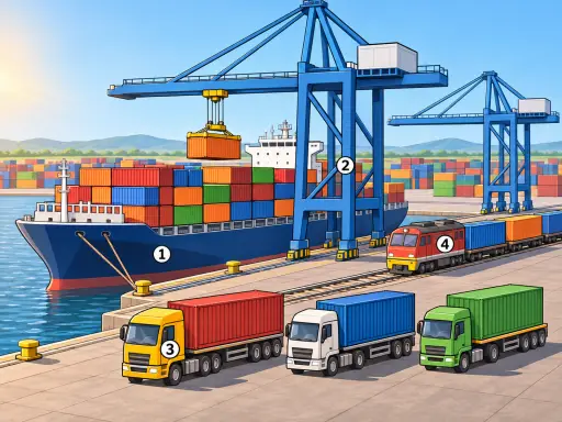
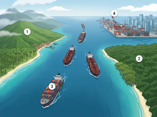
In the picture
- A glowing lane across open water: a busy sea route carrying trade between continents
- The narrow strait between a peninsula and an island: a chokepoint where ships funnel through a few kilometres of water
- A cargo vessel in the line: ships queue and wait their turn to pass
- Gantry cranes above stacked containers: the port where sea freight is loaded and unloaded
Examples
- A smartphone made in East Asia and sold in Europe: its parts crossed the sea in containers.
- Petrol in a car tank: the crude oil reached the refinery on a tanker that passed through a narrow strait.
Key takeaways
- Roughly 80–90% of world trade by volume is carried by sea.
- A handful of narrow straits — Malacca, Hormuz, Bab-el-Mandeb, Suez, Panama — handle a large share of that traffic.
Quiz: Sea lanes and narrow straits (Age 17)
-
According to the card, how do most goods traded between continents travel?
-
Roughly what share of world trade by volume is carried by sea?
-
What is the role of narrow straits such as Malacca, Hormuz, Bab-el-Mandeb, Suez and Panama?
The answers, each with its explanation, are in the app. This lesson has left the free week, so its quiz is part of the subscription.
Free app, optional subscription
App Store Google Play
Carry on in the app
At least one new illustrated lesson every weekday for your child’s year, with its quiz and a reminder at 6:15 pm.
Your child’s teacher does not use My Enhanced Teacher yet?
Tell them about it