Mon Prof Augmenté
The Strait of Malacca, a Maritime Highway
Age 17 · Geography
Open to everyone until Thursday, November 19
To keep it, print it while it is open.
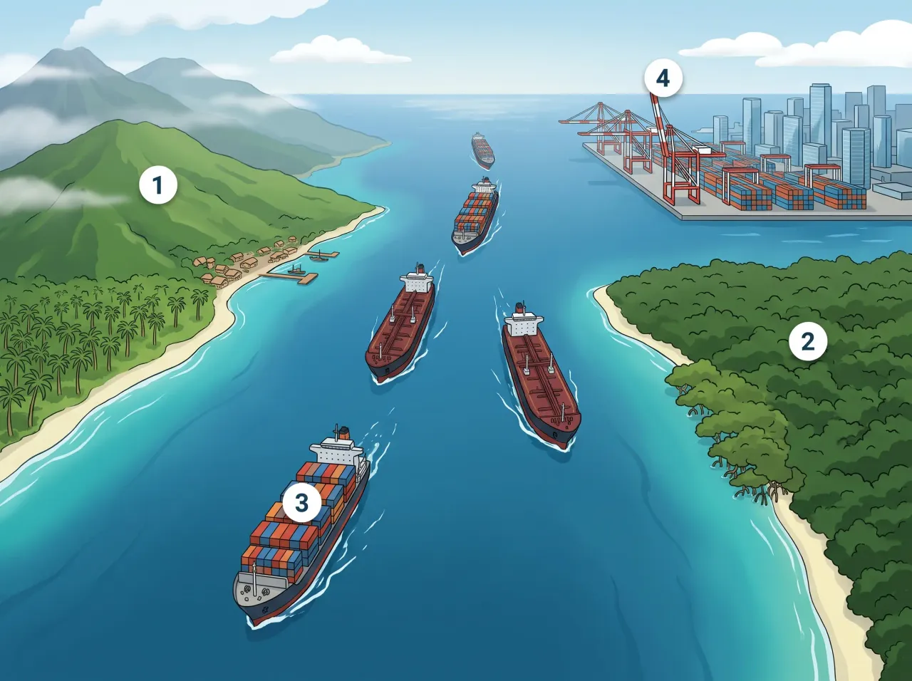
The Strait of Malacca is a narrow channel between Sumatra and the Malay Peninsula that connects the Indian Ocean to the Pacific. Tens of thousands of ships pass through it every year, which makes it one of the most strategic chokepoints of globalisation.
In the picture
- Sumatra (Indonesia): the western shore of the strait
- Malay Peninsula (Malaysia): the eastern shore of the strait
- Container ships and oil tankers in single file: a crowded shipping lane between Asia, the Middle East and Europe
- Port of Singapore: a giant hub at the narrow exit toward the Pacific
Examples
- A smartphone assembled in China can travel through the strait on its way to a shop in Europe.
- Oil from the Persian Gulf crosses the strait in tankers to supply Japan and South Korea.
Key takeaways
- Around 80% of world trade by volume travels by sea.
- A blocked strait, such as Malacca, Hormuz or Suez, can disrupt supply chains across the whole world.
Quiz: The Strait of Malacca, a Maritime Highway (Age 17)
-
Which two oceans does the Strait of Malacca connect?
-
Roughly what share of world trade, by volume, travels by sea?
-
Why can a blocked strait such as Malacca, Hormuz or Suez be a problem far beyond its own region?
The answers, each with its explanation, are in the app. This quiz is free there while the lesson is in the free week.
Get the app
Free app, optional subscription
App Store Google Play
Carry on in the app
At least one new illustrated lesson every weekday for your child’s year, with its quiz and a reminder at 6:15 pm.
Your child’s teacher does not use My Enhanced Teacher yet?
Tell them about it