Mon Prof Augmenté
Choosing a route in the forest
Age 16 · Sports
Open to everyone until Sunday, November 15
To keep it, print it while it is open.
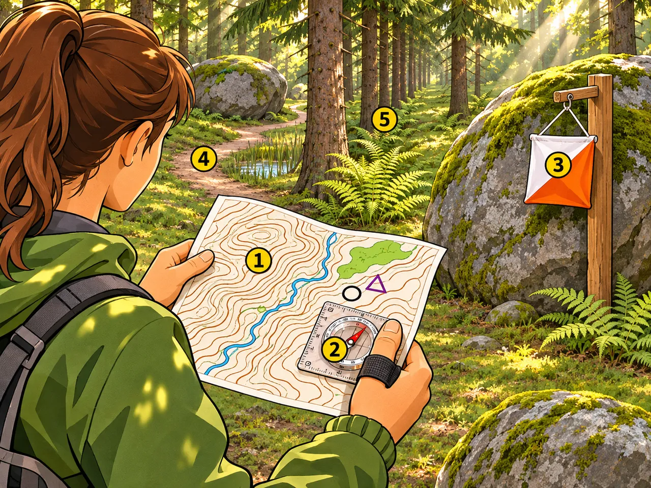
In orienteering you read a detailed map and a compass to pick the best way between control points in terrain you do not know. You weigh a longer easy path against a shorter line through trees, hills and wet ground.
In the picture
- Contour map: hills, streams and open or wooded areas shown in detail
- Thumb compass: the red needle points north so you can turn the map to match the land
- Control flag: the next point to reach, marked on the map
- Winding path: a longer but easier and faster-running route
- Straight line through the forest: a shorter route that crosses slopes and thick undergrowth
Examples
- Choosing a longer trail around a marsh instead of wading straight through it
- Turning the map until north lines up with the compass needle before setting off
Key takeaways
- The shortest line on the map is not always the fastest route
- Line up the map with north, then check landmarks as you go
Quiz: Choosing a route in the forest (Age 16)
-
On the map, the control flag is straight ahead. Why might the shortest line still not be the fastest route?
-
What do you use the compass for when you read the map?
-
In unfamiliar terrain, how should you choose between a winding path and a straight line through the forest?
The answers, each with its explanation, are in the app. This quiz is free there while the lesson is in the free week.
Get the app
Free app, optional subscription
App Store Google Play
Carry on in the app
At least one new illustrated lesson every weekday for your child’s year, with its quiz and a reminder at 6:15 pm.
Your child’s teacher does not use My Enhanced Teacher yet?
Tell them about it