Mon Prof Augmenté
Plotting a Sea Course
Open to everyone until Friday, October 2
To keep it, print it while it is open.
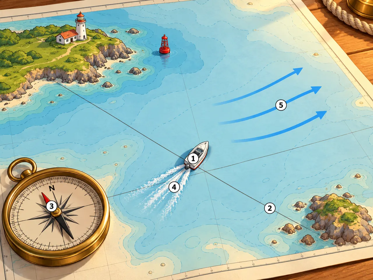
A navigator draws a line from the starting point to the destination, then adjusts it for wind, compass error and moving water. The final heading is the direction the boat must steer so it arrives at the planned place.
In the picture
- The boat’s plotted position at the crossing of two course lines
- The straight course line running to the destination island
- The compass needle: magnetic declination, the angle between compass north and chart north
- The boat’s wake angled away from its centreline: leeway caused by wind
- The blue curved arrows: the direction and speed of a current
Examples
- A ferry captain steers slightly up-current to dock at the correct pier.
- A kayaker aims upstream to cross a river straight across.
Key takeaways
- A course line shows the intended track; the heading is what you steer after corrections.
- Wind, compass error and current can each push a boat off the planned line.
Carry on in the app
Three questions on this lesson, to check the idea stuck. Free in the app while the lesson is in the free week.
At least one new illustrated lesson every weekday for your child’s year, with its quiz and a reminder at 6:15 pm.
Get the app
Free app, optional subscription
App Store Google Play