Mon Prof Augmenté
Orienteering with map and compass
Age 12 · Sports
Open to everyone until Tuesday, November 24
To keep it, print it while it is open.
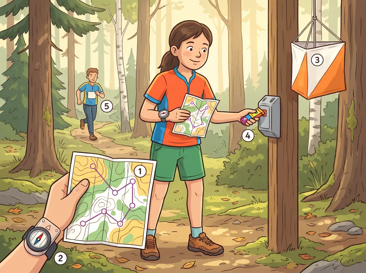
In orienteering you find your way through unfamiliar land using a map and a compass. You visit control points in the right order, either alone or with a team.
In the picture
- Terrain map: shows paths, hills and the course to follow
- Thumb compass: its needle points north so you can turn the map to match the land
- Control marker: the flag that shows you have reached the right point
- Electronic stick: touches the box to record your visit
- Teammate: shares the route choices and the effort
Examples
- Racing through a park to find marked posts in numbered order
- Working out with friends which path is quickest to the next post
Key takeaways
- Turn the map so it matches the land, using the compass needle
- Visit every control in order and check the code before moving on
Quiz: Orienteering with map and compass (Age 12)
-
In orienteering, what do you use the compass needle for?
-
You have just reached a control. What should you do before moving on?
-
What is the point of doing orienteering with a teammate?
The answers, each with its explanation, are in the app. This quiz is free there while the lesson is in the free week.
Get the app
Free app, optional subscription
App Store Google Play
Carry on in the app
At least one new illustrated lesson every weekday for your child’s year, with its quiz and a reminder at 6:15 pm.
Your child’s teacher does not use My Enhanced Teacher yet?
Tell them about it