 Mon Prof Augmenté
From Spring to Estuary
Age 15 environmental science
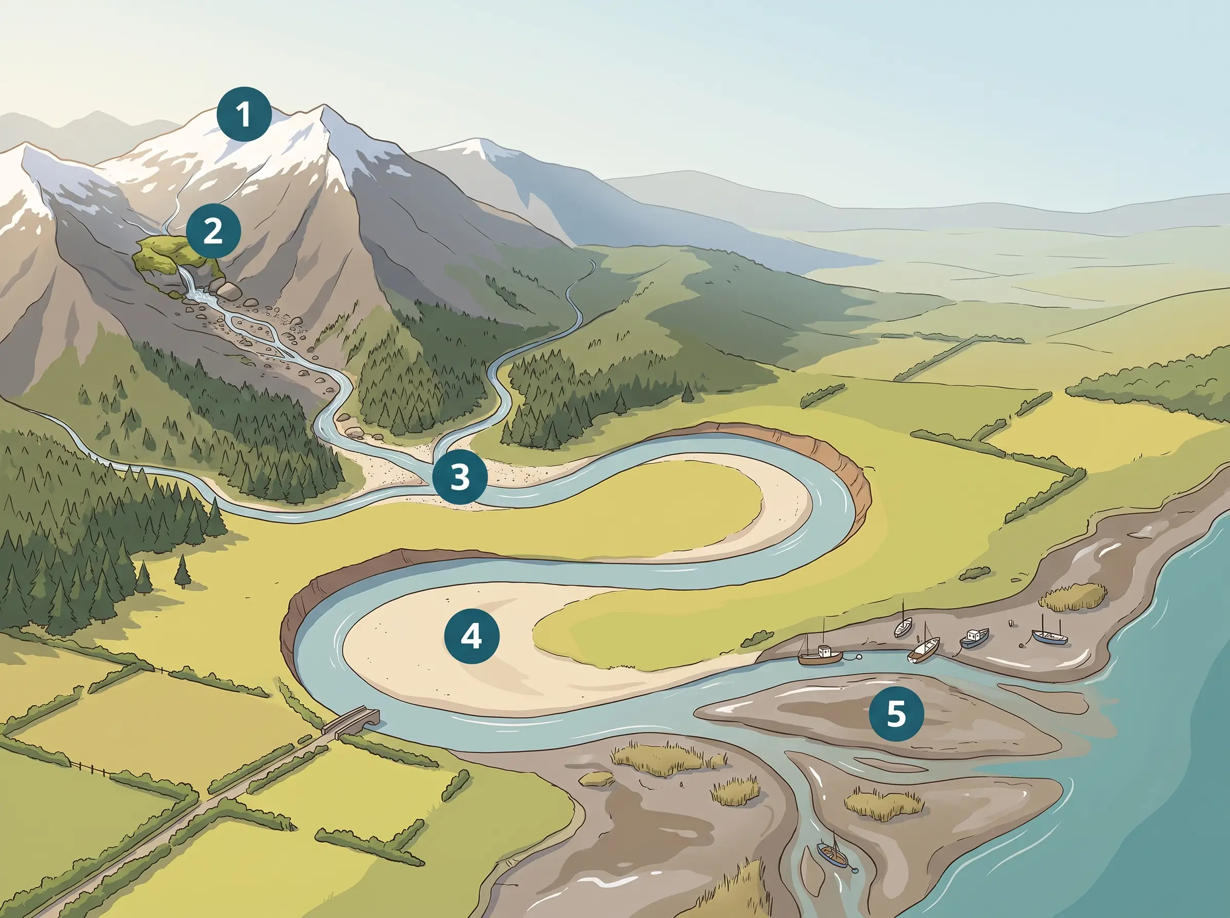
A river catchment is all the land whose rainfall drains into one river system, bounded by high ridges called the watershed. Water starts at a small upland spring, gathers tributaries, loops across a wide floodplain, and finally mixes with salt water in the estuary.
Step by step
- The ridge crest — the watershed boundary that separates this catchment from the next one.
- The spring in the mossy rock notch — where groundwater reaches the surface and the channel begins.
- The gravel bar at the confluence — where tributaries join the main channel and its discharge grows.
- The sand bank inside the river bend — sediment dropped where the current slows on the inside of the curve.
- The mudflat in the estuary — where the river meets the tide and releases its finest sediment.
Examples
- Rain falling on your roof runs into the gutter, then a drain, then a local stream — the same gathering pattern at a tiny scale.
- The Thames in London is still tidal near its mouth, so the water level rises and falls twice a day.
Key takeaways
- High ground defines a catchment, because ridges decide which way water flows.
- Discharge grows downstream as tributaries join, and sediment settles wherever the flow slows down.
A quiz goes with this lesson
Three questions asked a few days later, to check the idea stuck — not that the picture was seen. In the app, with a subscription.